CHAPTER 18
GREENLAND IS BIG ENOUGH
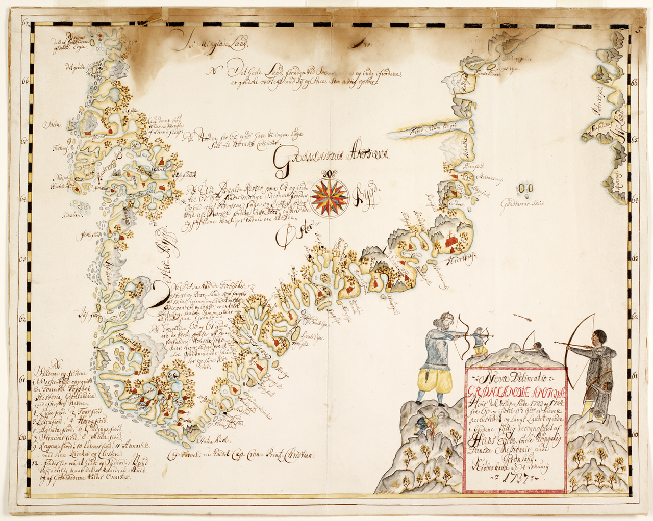
Figure 18.1. Hans Egede's Map of Greenland, 1737. Seen in its own geographic frame, Greenland is a place of coasts, fjords, routes and communities rather than an oversized silhouette near the top of a rectangular world map. Royal Library, Denmark / World Digital Library. Free to use and reuse.
Correct the area distortion and Greenland becomes much smaller, but it does not become unimportant.
On Mercator, Greenland is famously enlarged. An equal-area map substantially reduces its visual share of the world.[1] The correction is real, but the political geography remains.
On 4 January 2026, Donald Trump told reporters aboard Air Force One that the United States needed Greenland for national security, described the island as strategically important and invoked Russian and Chinese activity around it.[2]
.jpg?width=1800)
.jpg)
The two facts invite an easy inference: Greenland looks huge on Mercator, Greenland attracts geopolitical attention, so perhaps the map made powerful people imagine the island as more important than it really is. Greenland does not need the projection’s help. Its strategic value begins with position.
At Pituffik Space Base in north-west Greenland, the United States operates infrastructure for missile warning, space surveillance, satellite communications and control.[3] The base’s extreme latitude is not an inconvenience to be corrected on a map. It is part of the reason the location is useful. Polar-orbiting satellites pass over high latitudes repeatedly. A northern tracking station can see them often. U.S. Space Force material in 2026 described Pituffik as the northernmost station in its Satellite Control Network and noted the frequency with which polar-orbiting spacecraft can come into view.
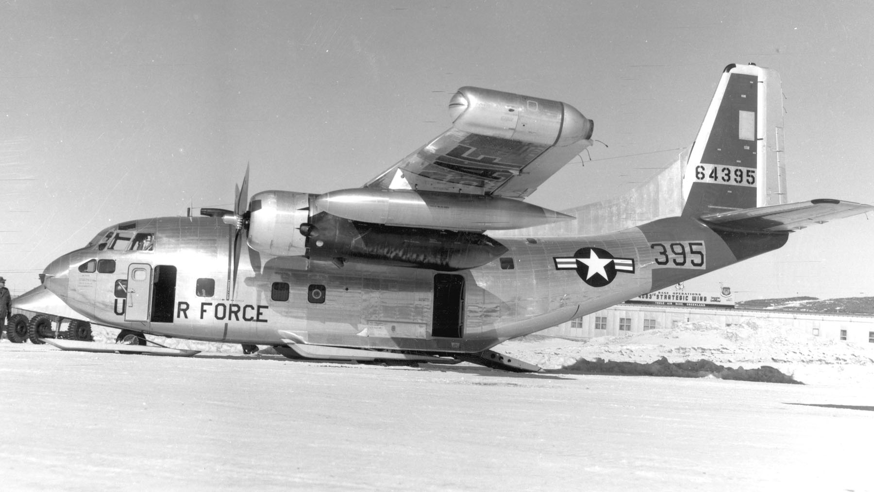
Figure 18.2. U.S. Air Force C-123J at Thule Air Base, Greenland, 1958. Greenland's strategic importance rests partly on its high-latitude position, not on how large it appears in Mercator. U.S. Air Force / National Museum of the U.S. Air Force. Public domain.
A corrected equal-area world map does nothing to that geometry. Shrink Greenland on the page until its area relationship with Africa is right and Pituffik stays where it is. The satellites still pass overhead. The Arctic remains between North America, Europe and Russia. Long-range aviation still crosses northern routes. Sea ice, undersea infrastructure and military surveillance still make the region operationally important.
For those questions, the useful map may not be a world map at all. It may be a polar projection showing Arctic states around the North Pole, or a specialised map of radar horizons, satellite ground tracks, sea approaches, military installations or great-circle routes. A Mercator rectangle is a poor instrument for understanding the real strategic geography even when its oversized Greenland happens to catch the eye.
Map size and strategic importance are different variables, and that distinction becomes even more important when Greenland is discussed as territory rather than geography.[4]
A large blank shape on a world map encourages an old habit: talking about land as though it were an object whose future is decided elsewhere. Greenland’s political status is much less simple.
Greenland has extensive self-government within the Kingdom of Denmark. The 2009 Self-Government Act recognises the people of Greenland as a people with a right to self-determination under international law and sets out a process under which a decision on independence belongs to the Greenlandic people, followed by negotiations and democratic approval.[5]
That legal fact matters more to Greenland’s political future than the size of its polygon on a world map, a point that became especially visible during the political arguments of January 2026. Greenlandic leaders repeatedly insisted that Greenland’s future must be decided by Greenlanders. A joint statement from major political parties placed Greenlandic agency at the centre, and Prime Minister Jens-Frederik Nielsen rejected the idea that Greenland should be owned or governed by the United States while also affirming cooperation within existing security relationships.[6]
The political map can therefore distort in a way projection mathematics cannot measure. If a news graphic reduces the situation to arrows between Washington and Copenhagen, Nuuk can disappear from its own story. That is not a Mercator problem but a framing problem.
The same caution applies to minerals. Greenland attracts international attention because of its geology and the possibility of resources important to modern industry. But a map covered in mineral symbols can make potential look like production. A deposit is not a mine.[7] A geological occurrence is not a commercially recoverable reserve. Infrastructure, energy, regulation, finance, environment and local political decisions determine what can actually be developed. Greenland’s own mineral authorities maintain detailed licensing and geological information precisely because the word resources is not enough.
Correcting Greenland’s visual area changes none of that. The island’s ice sheet remains enormous, its settlements remain concentrated around the margins, its population remains small relative to its territory, its geology remains specific, its sovereignty remains politically complex and its latitude remains extreme.
The Arctic itself reinforces the point. Recent American and NATO strategy documents describe a high north shaped by military activity, alliance geography, climate change, new operating conditions and closer attention to Russian and Chinese activity.
Those strategic concerns exist on a globe, an equal-area map, a polar map and a Mercator map. The projection may affect how the region looks, but it does not create the region’s location.
Greenland is therefore a useful test for claims about map power. It contains a spectacular visual distortion and an abundance of real-world reasons for attention. Any argument that jumps directly from the first to the second has to pass through too many alternative explanations.
The alternative explanations are substantial. Pituffik and polar-orbit geometry exist independently of the projection, as do Arctic approaches to North America, Russian Arctic capabilities, alliance geography, mineral prospects, climate-driven changes in access and Greenland’s own constitutional and independence debate. A map can contribute to how people imagine these facts, but it cannot substitute for them.
Projection may still matter psychologically, but Greenland provides a clean way to separate two questions: what makes the island strategically important, and whether a distorted map changes how people judge that importance. The first belongs to geography and politics; the second can be tested.
Here Greenland’s role is simpler: it shows what remains after the projection is corrected.
Correcting Greenland’s area does not make political importance proportional to size. An equal-area map is excellent for seeing how much territory the island occupies relative to Africa, but not necessarily for asking which satellites Pituffik can see, how Arctic states relate around the pole, where sea routes pass or how ice affects operations. Area is one geographic property among many.
Draw Greenland at the right relative area and it is still positioned between continents and oceans, still connected to Arctic security, still governed through its own political institutions and still home to people whose decisions matter more to its future than any outsider’s map. That leaves a narrower question: once geometry and real geography have been separated, what evidence do we have that the picture itself changes what a viewer thinks?