CHAPTER 12
THE SECRET NUMBERS BEHIND EVERY DIGITAL MAP
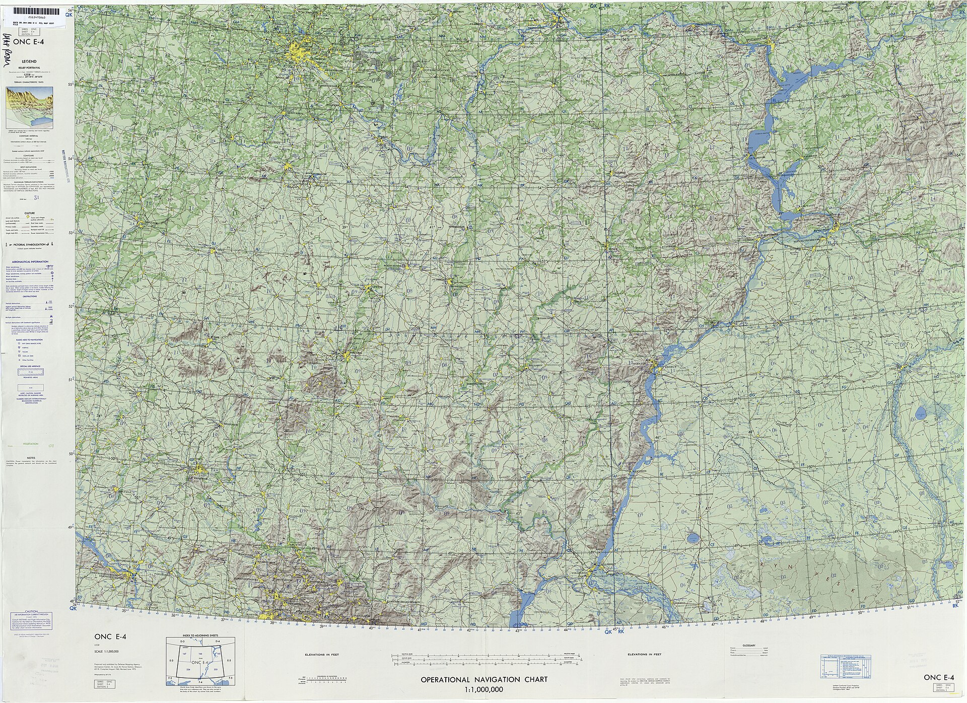
Figure 12.1. Operational Navigation Chart E-4, 1974. Its printed technical specification names the Lambert Conformal Conic projection, standard parallels and centre longitude, making the coordinate reference system part of the map's operational meaning. U.S. Defense Mapping Agency Aerospace Center. Public domain.
A coordinate can look wonderfully precise and still be useless.
Give a GIS user two numbers such as 174.7762 and -41.2865 and they may reasonably suspect longitude and latitude near Wellington. Give the same person numbers around 1,748,000 and 5,428,000 and they may suspect metres in a New Zealand projected coordinate system. Give either pair to software without telling it what the numbers mean, however, and the confidence disappears.
The computer has no instinct for Wellington. It has numbers, and numbers need rules.
This is one of the least visible facts in digital mapping. Every point, line and polygon is interpreted inside a coordinate reference system. The system tells the software what the axes mean, which units are being used, what geodetic framework the coordinates belong to and, if the data have been projected, how the curved reference surface has been turned into a plane.
When those rules are correct, the result feels effortless. Layers line up. Roads meet bridges. Parcels sit under imagery. A user assumes the computer simply knows where everything is. When the rules are wrong, digital geography becomes surreal very quickly. A dataset can appear in the Atlantic instead of Auckland. Metres can be treated as degrees. Longitude and latitude can be swapped. Correct coordinates can be assigned the wrong reference and plotted faithfully in the wrong place.
The modern geospatial world deals with this through formal definitions and identifiers. Four codes recur throughout this book: EPSG:4326, EPSG:3857, EPSG:2193 and EPSG:8857. Two more become important when the world is turned towards the Pacific: EPSG:8858 and EPSG:8859.
They look like model numbers or versions. They are neither. A larger number is not more advanced. The codes are identifiers in a registry. Each points to a particular coordinate reference system definition.[1]
The registry’s origins lie somewhere less romantic than astronomy or exploration: the petroleum industry.
In 1985, the European Petroleum Survey Group created a dataset of geodetic parameters for use by its members. Oil and gas companies worked across national borders and offshore areas where the same physical location might be represented by different datums, projections, units and coordinate conventions. A well or seismic line described only by two numbers could be ambiguous, and ambiguity around expensive infrastructure is expensive ambiguity.
The dataset became public in 1993. When the European Petroleum Survey Group was later disbanded, maintenance continued within what is now the International Association of Oil and Gas Producers. The old initials survived. EPSG became one of the hidden pieces of infrastructure underneath modern GIS.
Start with 4326. EPSG:4326 is the WGS 84 geographic two-dimensional coordinate reference system.[2] It expresses position as angular latitude and longitude in degrees. It is global and common in geographic data exchange. It is frequently called a projection in casual conversation, but it is not a projected CRS. It describes geographic coordinates on WGS 84 rather than a particular flat map.
That distinction becomes practical when software has to transform coordinates. Telling software what CRS existing numbers already use is not the same as converting those numbers into another CRS.[3] The first operation assigns meaning. The second calculates new values.
Confusing the two is a classic GIS failure. If NZTM2000 metre coordinates are incorrectly labelled as WGS 84 latitude and longitude, the software generally trusts the label. The data may vanish or appear somewhere absurd. Correct reprojection requires the software to know the true source system first, then calculate coordinates in the target system.
A CRS is therefore not decorative metadata. It is part of the data’s meaning.
EPSG:4326 also carries an axis-order trap. Formal EPSG definitions specify latitude then longitude, while many web and programming conventions use longitude then latitude because they think in x then y. Software and standards have handled this differently over time. For New Zealand, values around 175 and -41 make the danger obvious: reverse them and the supposed latitude is impossible.
Standards work often consists of preventing this kind of afternoon.
Now take 3857. EPSG:3857 is WGS 84 / Pseudo-Mercator, the projected coordinate reference system underlying a large part of modern web mapping.[4] Its coordinates are expressed in projected metres, and its formal scope is web mapping and visualisation. It provides the square, Mercator-like world used by many slippy-map systems.
For this chapter, that is enough. EPSG:3857 is not a better version of 4326. The two often work together. A database may store global positions in 4326 while a web map transforms them into 3857 for display. The next chapter follows the engineering history that made 3857 so dominant.
Then there is 2193. EPSG:2193 is NZGD2000 / New Zealand Transverse Mercator 2000, usually shortened to NZTM2000.[5] It is a projected coordinate reference system in metres, designed for mainland New Zealand and recommended by Toitū Te Whenua for national mapping where local measurement and consistency matter.
The contrast with 3857 is useful. A global web map values compatibility with a worldwide tiling ecosystem. A survey, engineering or topographic job in New Zealand values a system designed around New Zealand. The same organisation can therefore use both. LINZ serves Web Mercator products for global interoperability and NZTM2000 products for New Zealand-focused work.
Using both is competent engineering rather than indecision. Finally, EPSG:8857 is WGS 84 / Equal Earth Greenwich. It is a projected CRS for very small-scale equal-area world mapping.[6] Very small scale here means a map showing an enormous geographic extent, typically the world. Equal Earth preserves relative area, and the registered EPSG definition is centred on Greenwich.
Two details matter. First, the code predates the 2025–2026 political campaign. The United Nations did not create EPSG:8857. The projection was published years earlier and then registered as a formal CRS. Political attention gave the code visibility, not mathematical existence.
Second, 8857 is only one registered Equal Earth CRS. EPSG:8858 centres the Americas on 90 degrees west, while EPSG:8859 centres Asia-Pacific on 150 degrees east. The latter is the registered Pacific-facing variant most directly relevant to New Zealand.[7] A mapmaker can still choose another central meridian, but a custom definition is not automatically one of these registered CRSs. A projection family and a registered CRS are different layers.
The codes therefore describe different jobs rather than competitors. EPSG:4326 supplies global geographic coordinates in degrees; EPSG:3857 supports much web mapping; EPSG:2193 is the New Zealand projected CRS designed for mainland national work; and EPSG:8857, 8858 and 8859 are registered Equal Earth CRSs centred on Greenwich, the Americas and Asia-Pacific respectively. The numbers are database keys, not a ranking.
That point becomes even clearer with EPSG:4357. It is a real code, but it is not a slightly newer version of 4326. It refers to a deprecated Moznet three-dimensional CRS associated with Mozambique. One wrong digit can therefore point to an entirely different record.
The EPSG dataset matters because coordinates are not self-describing. A value such as 174.8 does not announce that it is longitude. A value such as 5,428,000 does not announce that it is a northing. A pair of values does not tell a computer which datum, axis order, units or projection produced them.
The code acts as a compact contract: interpret these numbers according to this definition. GIS professionals develop defensive habits around that fact. They inspect coordinate ranges. They check units. They look at the area of use. They verify whether a CRS was genuinely known or guessed. They distinguish assigning a CRS from transforming into one. They compare a known point. These habits are not paranoia. They are geospatial literacy.
The public almost never sees this machinery. A person opens a map and expects a blue dot to sit beside the correct road. They do not see axis order, a transformation pipeline or an EPSG identifier. Modern GIS succeeds when hidden conventions produce an obvious result.
The current Equal Earth debate makes one of those hidden identifiers unusually visible, and visibility can encourage the wrong conclusion. EPSG:8857 does not replace 4326, 3857 or 2193. It gives software a formal way to identify one particular Equal Earth world CRS when that is the job.
The most important lesson is therefore not memorising a list of numbers. It is learning that every coordinate arrives with assumptions, and that software needs those assumptions stated precisely.