CHAPTER 9
THE LINE THAT SURVIVED THE WAR
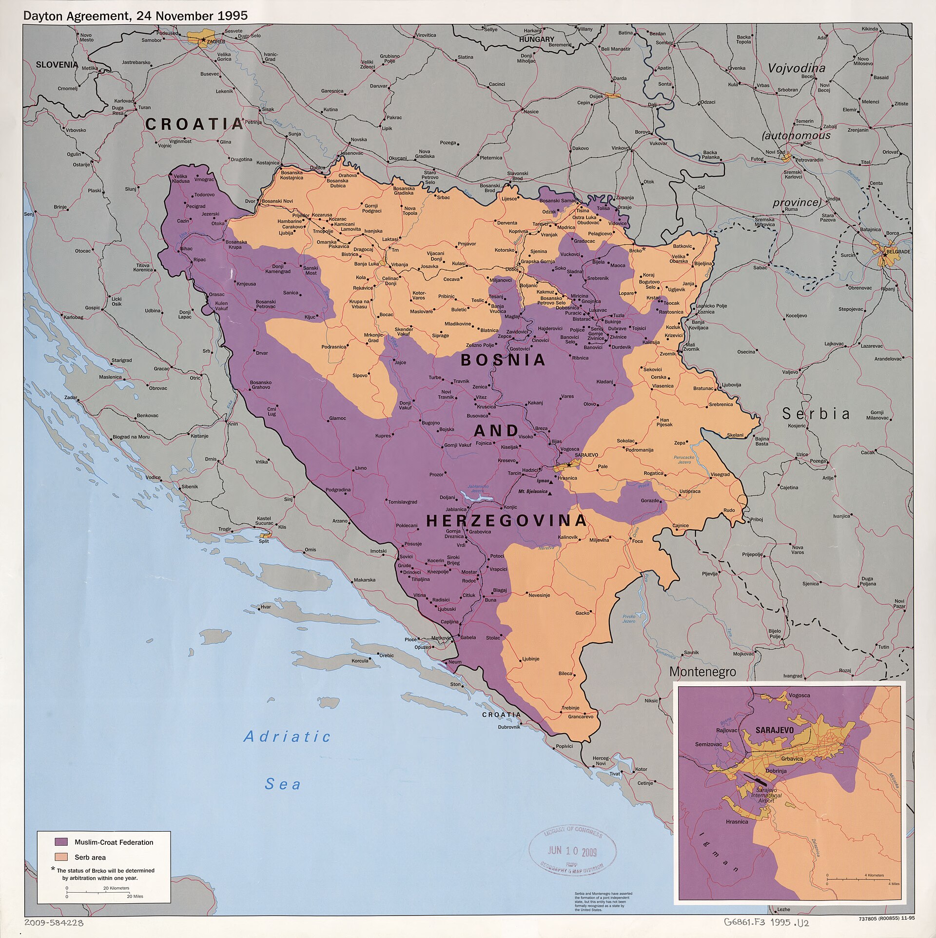
Figure 9.1. Dayton Agreement map, Bosnia and Herzegovina, 24 November 1995. The settlement line is not merely described in words: the political arrangement is made visible and operational through a map. U.S. Central Intelligence Agency / Library of Congress, Geography and Map Division. Public domain.
On 30 November 1948, two military commanders sat down in Jerusalem with a map between them and tried to stop people killing one another.
The city had been fought over for months. Roads were cut, neighbourhoods divided and positions seized and lost. Israeli and Jordanian forces faced each other across a city that no longer functioned as one place. What they needed that day was not a final constitutional settlement or an internationally recognised frontier. They needed to establish where the troops would stop.
Moshe Dayan, commanding Israeli forces in Jerusalem, and Abdullah el-Tell, representing the Arab Legion and other Arab forces in the city, marked the positions held by their sides on an attached map with thick grease-pencil lines.[1] A Law Library of Congress review, using a copy from the Israel State Archives, records that the red and green strokes were 3–4 millimetres thick and could represent roughly 60–80 metres in the city; in places the lines were disconnected or unclear.[2]
The scene is almost too neat as a metaphor: two men, one map, coloured pencils, one divided city. Its importance lies in what happened next. The line was intended to help stop fighting. It was not designed to settle every political question beneath it. Yet a line that is observed, patrolled, copied and administered can accumulate a life far beyond the emergency that created it.
In 1949, Israel signed separate armistice agreements with Egypt, Lebanon, Jordan and Syria. The Israel-Jordan General Armistice Agreement, signed on 3 April, carefully defined military demarcation lines while stating that the arrangement was without prejudice to later territorial settlements or claims.[3]
That wording matters. An armistice line can tell armed forces where they may operate without becoming an ordinary sovereign boundary by that fact alone. The geometry on a small-scale map may look similar, but legal status comes from the agreement and the history behind it, not from the thickness of the stroke.
The 1949 lines nevertheless became enormously important. Widely known as the Green Line, they structured movement, military positions and administration between 1949 and 1967.[4] In Jerusalem the division was physical. Barriers, no-man’s land, fortified positions and controlled crossings cut through streets and neighbourhoods. A route that had once been ordinary could become impossible because the line now shaped daily life.
The line became lived geography without thereby becoming a complete answer to sovereignty. After the 1967 war, when Israel took control of territories beyond the 1949 armistice lines, the Green Line remained a powerful reference. It supplied a common before-and-after for diplomacy, law and public discussion. The military arrangement had outlived the military configuration that first gave it practical force.
Temporary lines become durable when institutions begin depending on them. Patrol instructions use the line. Checkpoints require locations. Governments issue maps. Property, roads, utilities and movement adapt. Diplomats need a shared geographic reference. Journalists need a short name for a complicated territorial situation. Each repetition gives the geometry another reason to survive.
Maps participate in that durability because they make the line easy to reproduce. They do not cause the conflict or create the political claims behind it. They give those claims and arrangements a stable spatial form that can be copied into the next document.
Korea offers an even clearer example of a provisional military geometry becoming institutional structure.
On 27 July 1953, representatives of the United Nations Command, the Korean People’s Army and the Chinese People’s Volunteers signed an armistice at Panmunjom. The Korean War had devastated the peninsula and shifted front lines dramatically before fighting settled into a grinding contest near the middle. The armistice halted hostilities. It did not produce a comprehensive peace treaty or reunify Korea.
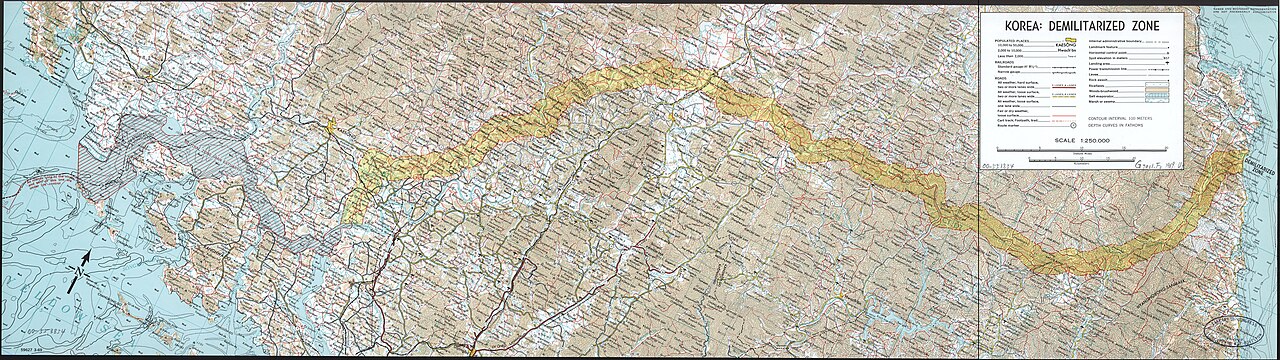
Figure 9.2. Korea Demilitarized Zone, 1969. The armistice line hardened into a mapped buffer that outlived the circumstances in which it was created. U.S. Central Intelligence Agency / Library of Congress, Geography and Map Division. U.S. government public domain.
Article I fixed a Military Demarcation Line on an attached map.[5] Each side was required to withdraw two kilometres, creating a Demilitarized Zone roughly four kilometres wide. The agreement required the line and the edges of the zone to be marked and created a supervisory system around the arrangement.
The sequence is almost laboratory-clean. First the line appears in the agreement. Then comes measurement, physical marking and withdrawal. Rules govern entry and crossing. A commission monitors the system. Geometry becomes administration.
The terminology needs care because simplified maps often turn the whole arrangement into one bold “border” line. The Military Demarcation Line is the line at the centre.[6] The DMZ is the wider zone created by withdrawals on both sides. The armistice remains an armistice rather than a final peace settlement. A general map may simplify this for legibility, but the simplification can change the history if the legend quietly turns a military arrangement into an ordinary treaty boundary.
More than seven decades later, the line and the DMZ remain central features of the peninsula’s military and political geography. The larger political settlement anticipated by the armistice did not arrive. What was provisional in legal purpose became durable in institutional practice.
Jerusalem and Korea are very different histories and should not be collapsed into one model. The useful comparison is narrow. In both cases, military necessity created mapped lines with limited immediate purposes. Those lines remained long enough for systems and expectations to accumulate around them.
The line survives because institutions grow around it. Moving a boundary vertex in GIS is geometrically easy and politically difficult. A line may be attached to roads, property, water systems, military positions, administrative records, cultural sites and memory. The geometry is the visible tip of a much larger arrangement.
Eventually, durable lines acquire another life inside digital systems. A paper agreement map can be scanned. The line can be digitised into coordinates and stored as a feature. The geometry can enter national databases, humanitarian systems, academic datasets and online maps. Digital copying gives the line extraordinary persistence because the coordinates can be duplicated exactly, including any approximation or mistake inherited from the original source.
This makes provenance essential. A GIS line should carry more than geometry. What document defines it? What date does it represent? At what scale was it captured? Is it approximate, disputed or generalised? Is it a sovereign boundary, a line of control, an armistice line or some other administrative object?
A line with coordinates to six decimal places may still rest on a thick pencil mark drawn during a ceasefire.
That sentence captures the tension between numerical precision and historical origin. Digital coordinates can look far more exact than the source from which they were derived. The map becomes dangerous when the precision of the storage format is mistaken for certainty about the status or original position of the line.
The Jerusalem story shows one route to durability. A rough emergency line can matter because later institutions repeatedly use it. Korea shows another. An armistice can build physical markers, withdrawal rules and supervisory arrangements around a mapped line from the beginning.
In both cases, the map is static while the durability is active. Political geography has to be maintained through patrolling, recording, negotiating, surveying, updating, crossing, preventing crossing and reproducing the line in official systems. The line has to be made real again every day.
Across these chapters, maps have moved from navigation and classrooms into treaties, surveys, intelligence, warfare and ceasefire administration. The common thread is operational: location becomes consequential when institutions can act on it. That raises a deceptively simple problem. Before a coordinate can guide a surveyor, soldier or phone, it has to answer a basic question: where are you on Earth?