CHAPTER 5
DRAW A LINE, CLAIM A WORLD
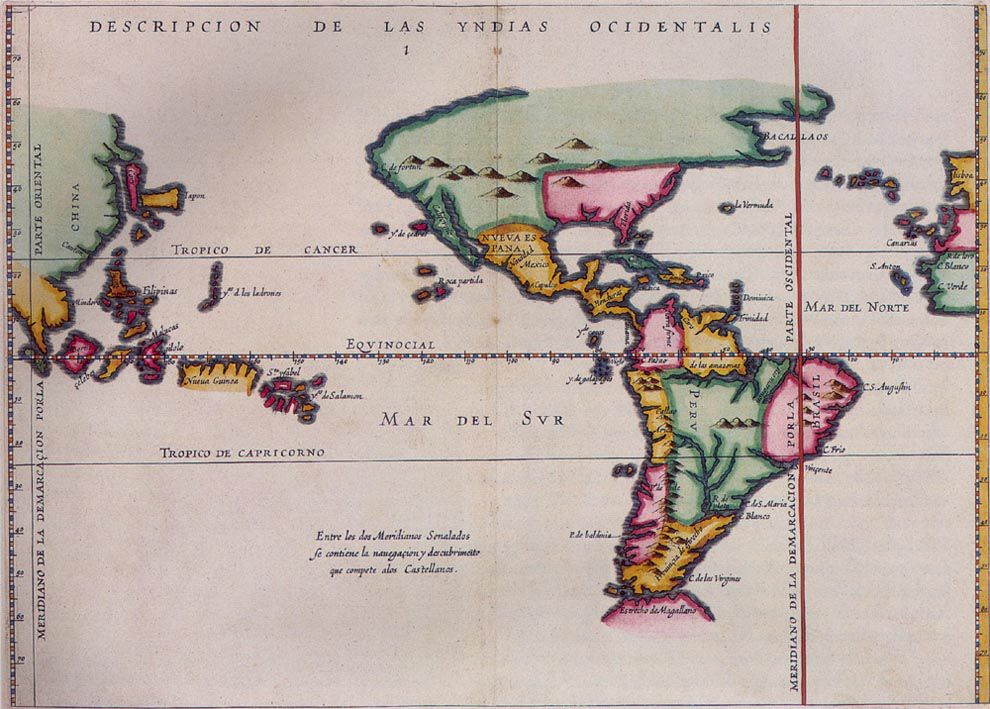
Figure 5.1. A seventeenth-century map showing the meridian associated with the Treaty of Tordesillas. The line is a reminder that an abstract division drawn on paper could be made to carry imperial claims across oceans and continents. Antonio de Herrera y Tordesillas, 1622. Public domain.
Long before anyone argued about Greenwich, people had discovered that a line could acquire an unusual authority once it was written down.
The British Museum holds dark boundary stones from ancient Babylonia known as kudurru.[1] They are not maps in the modern sense. They are legal objects recording grants, people, measurements and limits, sometimes surrounded by divine symbols. One surviving inscription from the eleventh century BCE describes such a stone as establishing a boundary forever.
Forever is an ambitious word for any boundary. Rivers move, markers disappear, states collapse and neighbours disagree. Yet the desire behind the word is familiar. A spatial decision has been made, and somebody wants it to persist after the people who made it are gone.
Maps are very good at giving such decisions geometry. They can translate a treaty, conquest, grant or compromise into something that can be seen, copied and later surveyed. The line on the page is not the same thing as authority on the ground, but it can become the spatial form through which authority is implemented.
In 1494, Castile and Portugal attempted this on a scale that still sounds audacious after five centuries of imperial history. The Treaty of Tordesillas, signed on 7 June, established a demarcation line from pole to pole 370 leagues west of the Cape Verde islands.[2] Lands on one side would fall within the Spanish sphere, lands on the other within the Portuguese.
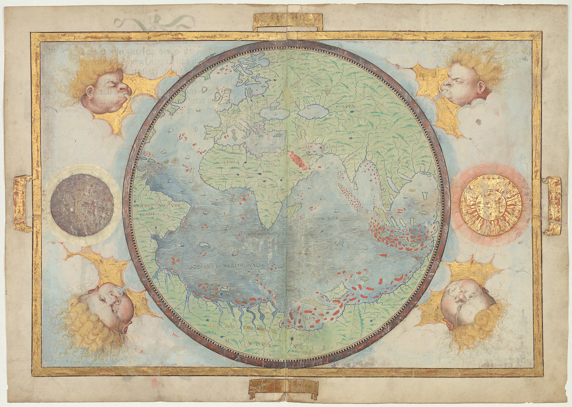
Figure 5.2. The Portuguese hemisphere from the Miller Atlas, 1519. The richly worked chart belongs to the imperial cartographic world created around voyages, claims and the attempt to divide newly encountered lands into rival spheres. Lopo Homem and collaborators / Bibliothèque nationale de France. Public domain.
The treaty had the confidence of geometry and the inconvenience of geography. Its negotiators were allocating rights across oceans and territories Europeans had not fully charted and, in many places, had never visited. The supposedly precise phrase “370 leagues west of the Cape Verde islands” immediately raised practical questions. Which island supplied the reference? How long was the league? How could longitude be measured accurately enough at sea in the late fifteenth century to place the line consistently?
The treaty did not make these problems disappear. It gave two rival states a geographic rule around which they could negotiate claims. That rule would have enormous consequences, including for Portugal’s position in what became Brazil. It also rested on a political premise rejected by the people already living in the territories being assigned.[3]
Modern maps can make Tordesillas look more settled than it was. Draw a clean north-south line, colour one side Spanish and the other Portuguese, and five centuries of uncertainty collapse into a confident graphic. The people who signed the treaty had no such finished layer. They had incomplete charts, astronomical techniques, negotiation and disagreement over what the words meant in actual geography.
That is one of cartography’s recurring powers and recurring dangers. A finished line can hide how hard it was to locate, who contested it and what authority made it consequential.
Three and a half centuries later, the Treaty of Guadalupe Hidalgo shows the process becoming more explicit. Signed on 2 February 1848, it ended the war between Mexico and the United States and transferred an immense territory to the United States. Article V described the new boundary in words, following the Rio Grande, the limits of New Mexico, the Gila River, the Colorado and a final straight line toward the Pacific. For the New Mexico portion, the treaty also referred specifically to an 1847 map published by John Disturnell.[4] A copy was attached and signed and sealed by the negotiators.
That sounds reassuring: if words are difficult, use a map. The Disturnell map, however, was not a perfect representation of the terrain the treaty was trying to divide. The boundary commission that followed had to reconcile the text, the mapped geography and the actual landscape. The treaty anticipated this by requiring each government to appoint a commissioner and surveyor. They were to meet, run and mark the boundary, keep records and produce plans whose agreed results would carry legal force.
The sequence is the important part. A political agreement defines a spatial relationship. A map helps represent it. Surveyors take the description into the field. Physical monuments and observations connect the legal words to the land. Administrators and later surveyors maintain the result.[5]
The line does not leap from paper into the desert; people carry it there. From 1848 into the 1850s, boundary-survey parties worked across thousands of kilometres of difficult country. They used astronomical observations, field measurement, reconnaissance and monuments to turn treaty language into recoverable positions. The surviving records show something that the clean modern border cannot: heat, distance, imperfect prior maps, field decisions and the labour of making a line real.
Most political maps give us the finished line first. Two colours meet neatly. The border has no broken instruments, no diplomatic correspondence, no disputed coordinate, no shifting river channel and no surveyor trying to decide where a sentence written in a capital touches the ground. The final line hides the work and uncertainty that produced it.
Repetition then gives the line another kind of strength. The same geometry appears in atlases, deeds, official documents, signs and digital datasets. A once-contested decision becomes an ordinary reference. Later users may encounter only the current boundary, with no reason to know how uncertain or politically charged its creation was.
Law, however, does not allow every printed line to become sovereignty merely by looking official. In 1986, the International Court of Justice considered a frontier dispute between Burkina Faso and Mali.[6] Both sides had submitted many maps and sketches, yet no indisputable boundary emerged from the pile. The Court treated maps, in ordinary circumstances, as information and evidence whose value depended on their reliability and relationship to the legal record, not as territorial title merely because a line appeared on them.
That is a useful antidote to visual confidence. A map can record a claim, illustrate an agreement, support an argument or help locate a boundary. Its legal function depends on the instrument and context behind it.
Sometimes that function is deliberately strong. The 1995 Dayton Peace Agreement that ended the war in Bosnia and Herzegovina incorporated mapped boundary material into the settlement and gave it a controlling role in implementation.[7] In that case the map was not merely a later illustration of the agreement. It was part of the machinery by which the agreement became spatially operational.
These examples are enough to establish the principle without turning every political line into the same legal category. Geometry does not announce its own authority. A treaty line, an administrative boundary, a ceasefire line and a disputed claim can look almost identical at small scale while carrying very different meanings.
The most durable boundaries combine several things: words that describe the decision, maps or coordinates that locate it, physical or surveyed evidence that lets later users recover it, and institutions prepared to act on the result. Remove any one of these and the line may become harder to maintain. Add all of them and a decision can outlive the generation that made it.
Political power repeatedly reaches for cartography when it wants geography to hold still. A state administering territory across great distances needs descriptions, surveys, registers and maps that allow officials who cannot see the land to speak about it consistently. The map does not replace law or force. It gives those systems a portable spatial language.
For a modern GIS user, this history is easy to forget. Add a country-boundary layer and the world appears instantly divided into polygons. The interface conceals the treaty, survey, river change, court judgment, dispute and administrative history beneath the line. Different datasets may still disagree, and a boundary may be de jure, de facto, disputed, provisional or generalised for display, but the software prefers a geometry it can store.
The map user sees a line. The analyst sees metadata. The lawyer sees a claim or instrument. The person living beside the line may see a checkpoint, a tax authority, a land title, a school system or a barrier between relatives. The same geometry can belong to all these realities at once.
The Babylonian boundary stone, Tordesillas and the U.S.-Mexico survey are separated by millennia and political systems, but they share the same practical problem: how do you make a spatial decision persist when the decision-makers are absent?
The durable answer usually combines all three: write the rule, draw the line and mark the ground.
Once the line has been fixed, another task begins. Everything inside it can be measured, divided and entered into records. That is where the surveyor becomes central, and in colonial New Zealand the consequences could be immediate enough to provoke people to pull the survey pegs straight back out of the ground.