CHAPTER 4
WHO GETS THE MIDDLE?
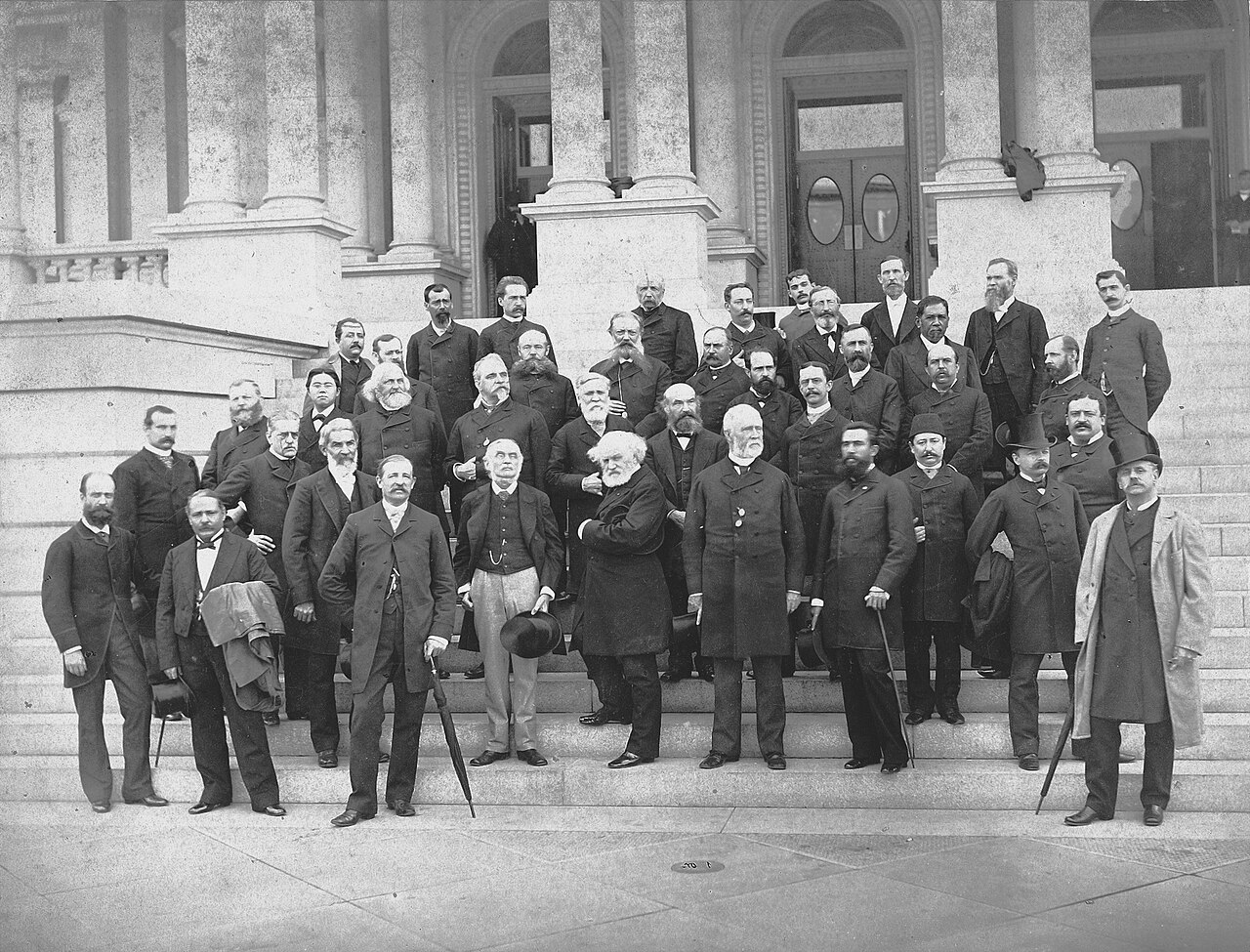
Figure 4.1. Delegates to the International Meridian Conference, Washington, October 1884. The meeting made Greenwich the shared prime meridian, turning a cartographic reference line into an international standard. U.S. Naval History and Heritage Command, NH 96688. Public domain.
On 1 October 1884, diplomats, astronomers, naval officers, engineers and surveyors filed into the Diplomatic Hall of the United States Department of State in Washington to settle a question that sounds almost too simple to require an international conference: where should zero longitude be?[1]
Latitude has a natural reference. The equator follows from the geometry of a rotating planet. Longitude is different. The Earth does not come with a line marked START COUNTING HERE. Every longitude system therefore needed an agreed beginning, and by the nineteenth century there were far too many.
France used Paris. Britain used Greenwich. Other charts and national systems referred to Cadiz, Naples, Ferro, Pulkova, Stockholm, Lisbon, Copenhagen, Rio de Janeiro and other meridians. A navigator could understand longitude perfectly and still need one extra piece of information before trusting a number: longitude from where?
Rear-Admiral C. R. P. Rodgers, the American chairman of the conference, described the problem from a seaman’s point of view. Passing ships might exchange longitudes hurriedly, sometimes by figures written on a blackboard. If the figures referred to different prime meridians, confusion followed. At sea, confusion could be dangerous.
The conference was therefore trying to agree on a common zero and, through related resolutions, bring the world’s clocks into a more orderly relationship with it. It was not choosing the best world projection. That distinction matters because a prime meridian, a map’s central meridian, the place where a flat map is cut, and the direction placed at the top are separate choices even though they can interact.
The delegates mostly had the first of those choices in front of them. The gathering itself was an unusually literal collection of the world around one table. Austria-Hungary, Brazil, France, Britain, Japan, Hawaii, Russia, Spain, Mexico, Switzerland, Venezuela and many other states sent representatives. The American Secretary of State welcomed them with language about serving the “civilized world”, a phrase carrying all the assumptions of its century.
Then they began arguing about Greenwich, where the practical case was formidable. A table presented to the conference counted 37,663 ships already using Greenwich longitude, about 65 per cent of the vessels surveyed and 72 per cent of the tonnage.[2] Paris accounted for about 10 per cent of ships and 8 per cent of tonnage. The remainder was divided among other national meridians.
This was standardisation’s strongest argument: do not imagine that the world is beginning from zero. Ask which change will disrupt the fewest existing charts, almanacs, instruments, printing plates, observatories and trained users. Greenwich had not won a philosophical contest about where longitude ought naturally to begin. It had accumulated infrastructure.
France’s delegates objected to turning practical dominance into universal scientific authority. The astronomer Jules Janssen argued that science itself had no reason to prefer Greenwich. Britain’s maritime power, chart-making reach and the amount of shipping already using its meridian were historical advantages, not laws of nature. To make them universal could look like science following the strongest existing power rather than choosing a neutral reference.
Janssen did not simply demand that Paris replace Greenwich. He argued for a neutral meridian, one that did not run through a national observatory and therefore would not award symbolic priority to one state.[3] The proposal was attractive in principle and awkward in practice. A meridian in the middle of an ocean would still need to be defined from an observatory somewhere, while the world would still face the cost of changing charts and systems.
One proposed compromise has particular appeal from a New Zealand perspective. Instead of Greenwich, why not use the meridian exactly opposite it, running largely through the Pacific? The line belonged to the same great circle and could be defined precisely from Greenwich, while zero itself would no longer pass through Britain. A speaker described such a Pacific meridian as potentially “international and in no respect national”.
The part of the world often pushed toward the edge of a familiar map was briefly considered as the place from which longitude might begin counting.
It did not win. Greenwich had observatories, charts, navigational practice and users on its side. A neutral Pacific zero had conceptual elegance. Greenwich had a much lower switching cost.
The Greenwich resolution passed on 13 October. That session’s roll call recorded twenty-one states in favour, San Domingo against, with Brazil and France abstaining.[4] When the conference adopted its Final Act on 22 October, the same resolution was recorded as 22–1–2, with Salvador included among the affirmative states.[5]
The conference had chosen a common reference, not moved the Earth. Governments still had to implement the decision, and France did not instantly abandon Paris longitude in every context. Standards acquire histories after the vote. What the conference established was an international answer to one question: where should east and west longitude begin?
It did not answer the more visible question of where the world should sit on a page. A familiar world map centred roughly on Greenwich keeps Europe and Africa continuous while dividing the Pacific between the left and right edges. New Zealand appears near one edge not because the planet puts it there, but because the map has been opened and arranged somewhere else. A Pacific-centred map reverses the emphasis. New Zealand, Australia, Asia, the Americas and the island Pacific can be seen around one continuous ocean, while the Atlantic takes the cut.
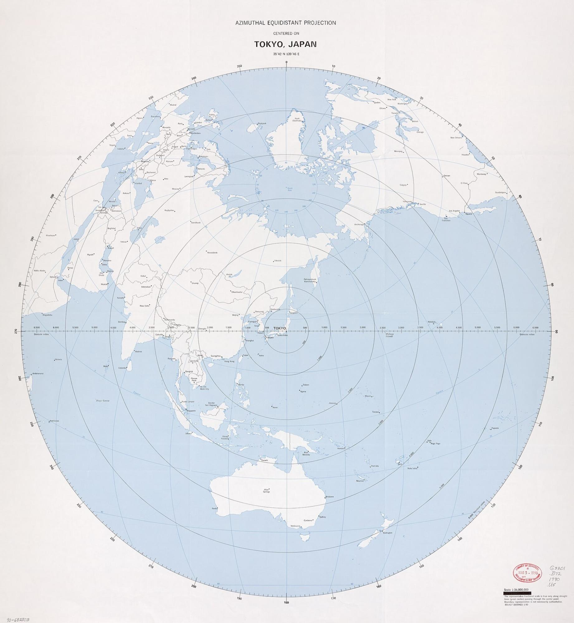
Figure 4.2. Azimuthal equidistant world map centred on Tokyo, 1990. Moving the centre changes the visual ordering of the world, while this projection also preserves distance from its chosen centre. U.S. Central Intelligence Agency / Library of Congress, Geography and Map Division. U.S. government public domain.
Nothing about Greenwich longitude has changed when the map is recentred. The prime meridian remains the reference from which longitude is counted.[6] The mapmaker has changed the central meridian of the display, the longitude chosen to sit near the middle of the picture.[7] The world’s bookkeeping can remain Greenwich-based while the map turns to face the Pacific.
This is one of the simplest and most useful distinctions in world cartography. Moving the middle of a map no more relocates the prime meridian than turning a globe on a desk moves Greenwich. It changes what the reader sees continuously and what is divided by the edge.
For Pacific mapping that can matter a great deal. The ocean is not blank space separating important continents. It is route, environment, territory, resource and history. A map cut through the Pacific can make a connected region look like two margins. Recentring the map can improve the geographic story without claiming that one centre is morally or mathematically ordained.
There is no natural middle of the surface of a sphere. Any point can face you when you turn a globe. A flat world map has to choose.
Orientation is similar. North-up feels natural to readers accustomed to it, and that familiarity can be practically useful, but there is no physical law placing north at the top of a sheet. Other mapping traditions have used different orientations. A convention can be arbitrary in origin and still become useful once millions of people share it.
That is the deeper lesson of the Washington conference. Greenwich was selected because existing use, shipping, science, cost, national prestige and the desire for interoperability all mattered. British maritime power and chart-making reach plainly helped create the advantage. So did the practical benefit of not rebuilding the navigational world from scratch. The result was neither an inevitable scientific discovery nor a story that can be reduced to one political motive.
The delegates did not discover Greenwich. They selected it, and once that reference was widely adopted it became easy to treat as natural. That is what standards do when they work well enough for long enough. They reduce the number of questions users have to ask. A navigator can exchange longitude without first naming a national observatory. A database can store geographic coordinates inside a shared reference. A clock can be related to a common time system. The price of that convenience is that the original choice becomes harder to see.
From New Zealand, the distinction between reference and presentation is especially useful. Greenwich can remain zero while the Pacific becomes the centre of a map. New Zealand can move from margin to middle without moving a metre on Earth. The edge is cartographic, not geographic.
The conference fixed one invisible line so ships, charts and clocks could speak a more common language. The next lines in this story were different. They were drawn to divide territory, and once political power attached itself to them, changing the line could mean changing who claimed the land on either side.